At the start of the French Revolutionary Wars, the Royal Navy suffered heavy losses owing to inadequate naval charts rather than enemy action. As a result, the Hydrographical Department of the Admiralty was established by Order in Council in 1795 to provide improved navigational information to the Fleet. Accurate charts were crucial for maritime exploration and trading voyages as well as for warfare, so at the end of Napoleonic Wars the Hydrographical Department expanded its operations, setting up the Surveying Service of the Navy. The new service had dedicated ships under the command of specialist naval surveyors and cartographers, one of whom was Vice Admiral Alexander Thomas Emeric Vidal RN, who is buried in St Andrew’s Churchyard, on the east side of Birdcage Walk.
Born into a naval family of Spanish and Huguenot extraction, Vidal enlisted in the Navy as a First Class Volunteer in 1803 at the age of ten. He served in the Channel, Spain and the West Indies before entering the Royal Naval College in 1807. Two years later he was back at sea as a Midshipman, then in 1815 he was commissioned as a Lieutenant while working in the Surveying Service in Canada, where he acquired a plot of land on the St Clair River.
On leaving Canada, Vidal spent the next seven years on the HMS Leven, a survey ship under orders to prepare detailed and accurate charts of the coast of Africa. The survey of the east coast – from the Cape to the Horn of Africa - is regarded as one of the most challenging ever undertaken by the Admiralty and it was during this part of the expedition that Vidal was promoted to Commander and then Captain.
Back in England, the Admiralty had received at least seven reports of a hazard in the North Atlantic known as Aitkin’s Rock. Several expeditions had failed to find the rock, so in 1830 the Admiralty put Vidal in command of HMS Onyx and HMS Leveret with orders to investigate. Having spent six weeks charting the reported locations of the rock and failing to find any evidence of its existence, Vidal concluded that the false sightings were probably due to floating debris or whales. While making his surveys, however, he discovered and charted Vidal bank off the coast of Northern Ireland. The following year, he became the first naval surveyor to chart the precise position of Rockall, a tiny but treacherous granite island in the North Atlantic, 240 miles west of the Outer Hebrides.
From 1835 to 1838, Vidal was continuing the survey of the West coast of Africa when he met Sarah Antoinette Veitch, daughter of the Consul-General of Madeira. They were married in 1839 and had two sons, Owen Alexander and Beaufort Henry, before Sarah died in 1843.
Following the death of his wife, Vidal emigrated with his sons to Canada, joining his older brother, Richard and his family who had settled at Port Sarnia on the junction of the St Clair River and Lake Huron. By 1863, Vidal had returned to England and was living in lodgings at 13 Sion Hill, Clifton when, at the age of 70, he died.
South side of the grave
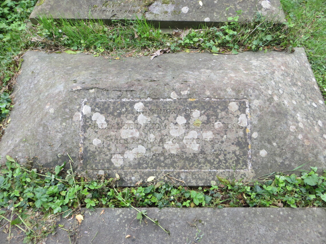
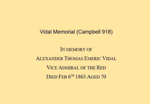
Grave inscription
Grave seen from Birdcage Walk - a simple hipped Pennant stone slab
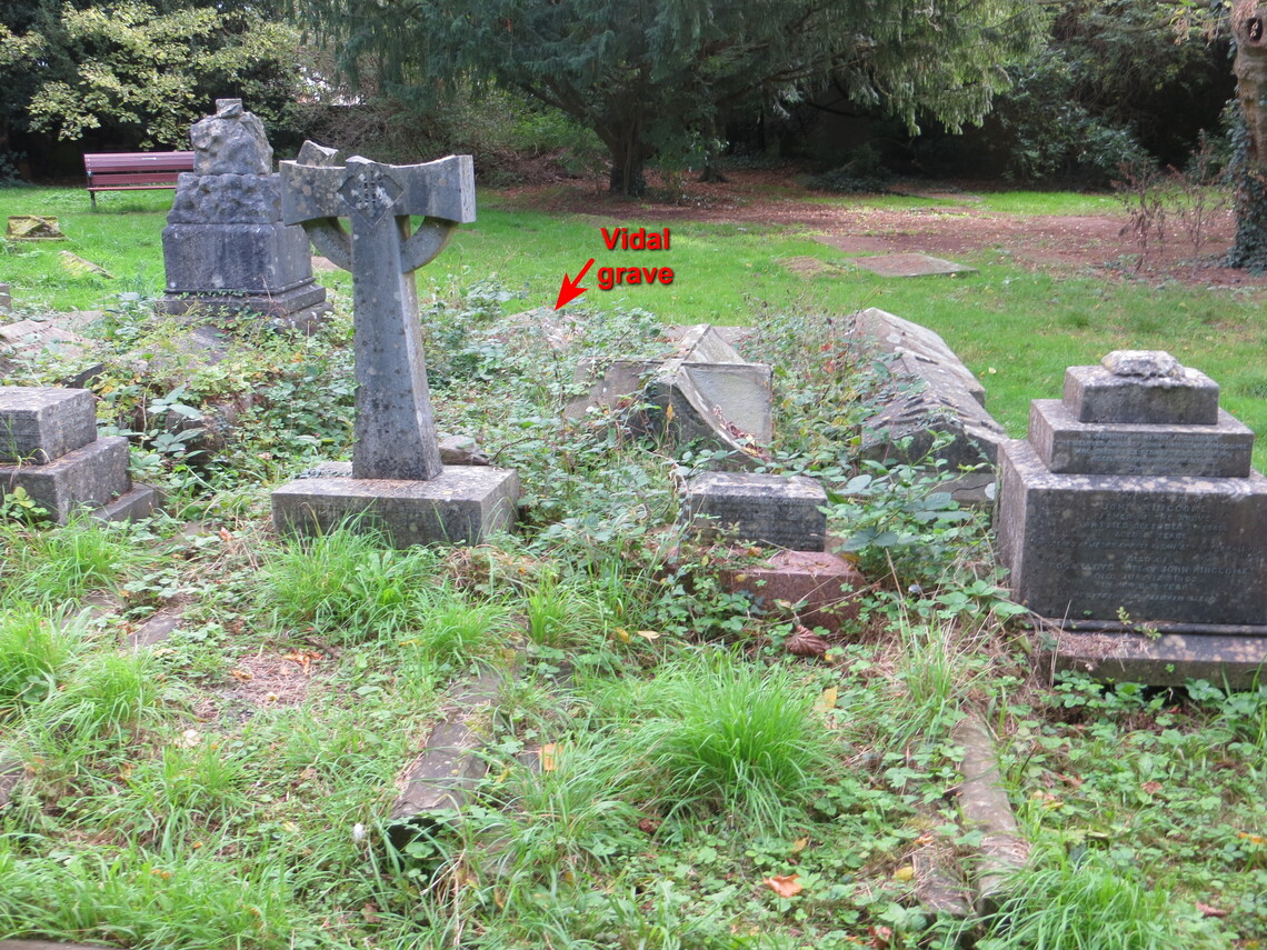
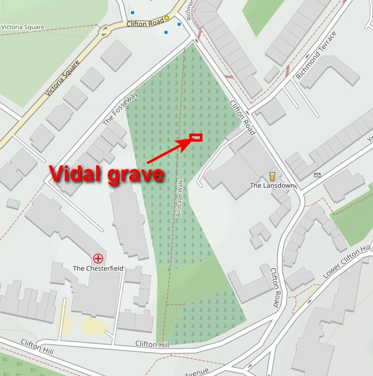
Location of grave in the churchyard - the grave can be viewed from Birdcage Walk. Be warned that walking among the crowded gravestones can be muddy and slippy underfoot, with many potential trip hazards.